


Laxey Tourism Information
About Laxey Village
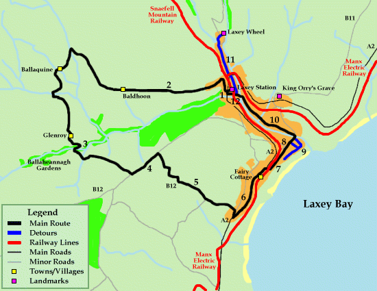
Laxey is located along the east coast of the island. With a width of over 2000 meters or 2(Km) the villages is a small peaceful area. Home to the worlds largest water wheel the laxey wheel. the wheel is one of the many icons of the isle of man and use to employe over 600 miners when it was functional. The lower part of laxey is the original settlement that laxey was built around called "old' Laxey originally small fishing harbour and village
"Laxey village winner of IOM Tourism Award for : Best Town OR Village 2011"
A Brief History of the Laxey and Lonan Districts
By Frank Cowin, FRICS
The Isle of Man has always been divided into two both adminitratively and socially. North and South have many differences although the dividing line actually runs North East to South West along the line of the hilltops.
Garff is the Northernmost Sheading (a Viking administrative division) of the South.
The Sheadings were divided into Treens and the Treens into (usually 4) quarterlands. These last are the old Manx farms of about 80 acres.
Almost every Treen had its own chapel (keeill) but in the late 12th century the parishes were created as both ecclesiastical and civil areas of administration. Garff originally consisted of the parishes of maughold, Lonan and Onchan, but Onchan was transferred to Middle in 1796.
One of the most important leeills was chosen as the Parish Church either because of its convenience or its religious associations.
As Lonan Old Parish Church is in the far corner of the Parish near the sea, it must have been chosen because of its dedication to Oran-Adomnan, Abbot of Iona and biographer of Columba.
In 1731 a new church was built nearer the centre of the parish but fortunately the old one survives.
By 1854 a church was required for Laxey - Christ Church designed by Ewan Christian, but did not become a separate ecclesiastical parish until 1917. Laxey had already become a separate civil administrative area in 1895.
After the visits of John Wesley in 1777 and 1781 Wesleyan Methodism flourished to be rivalled by the breakaway Primitive Methodists in the 1830s when their cause was strengthened by incoming mine workers. Methodist buildings, some still in use, others converted to houses or other use abound throughout both the parish of Lonan and the village of Laxey.
Laxey and Lonan are generally thought of as being purely a mining area, but there are many other things of interest both industrial and historic.
The original historic settlement was near the beach with a small grouping of fisherman's Crofts. The road came straight down the hillside from Douglas, forded the river and went straight up the other side passing through the lands of Rushen Abbey towards Ramsey. The roads were diverted towards the end of the 18th century to make them suitable for wheeled transport, thus forming Old Laxey Hill and Minorca and the bridge was built.
In the 1850s the New Road was constructed, continuing via Ramsey Road and Bulgham to rejoin the old road at the Dhoon.
In the 1890s the Electric Railway was constructed.
The remaining settlement in the area was mainly scattered farms served by mills - flour, wool, flax, and paper.
Mining started about 1781 rising to a peak about 100 years later, and then tailing off to finish in 1929.
Tourism followed the improved transport and made use of the natural beauty - Glen Gardens, Mountain Railway etc, the the industry in the form of the Wheel an even a water powered incline railway appeared to help move the crowds.
Now only a few of these things survive, but with care the remains of others can be discovered.
Useful contact numbers
Manx Gas
644444
Manx Electricity Authority
687687
DoI - Isle of Man Harbours
861663/686628
Isle of Man Transport - Bus Vannin
662525
Ramsey Police Station
812234
Police Headquarters
631212
Coastguard Administration
844740
Nobles (Main Hospital)
650000
Laxey Surgery
861350
Onchan Village Walk Surgery
656020